Bay Area 30 Year Earthquake Risk Projection
Goal
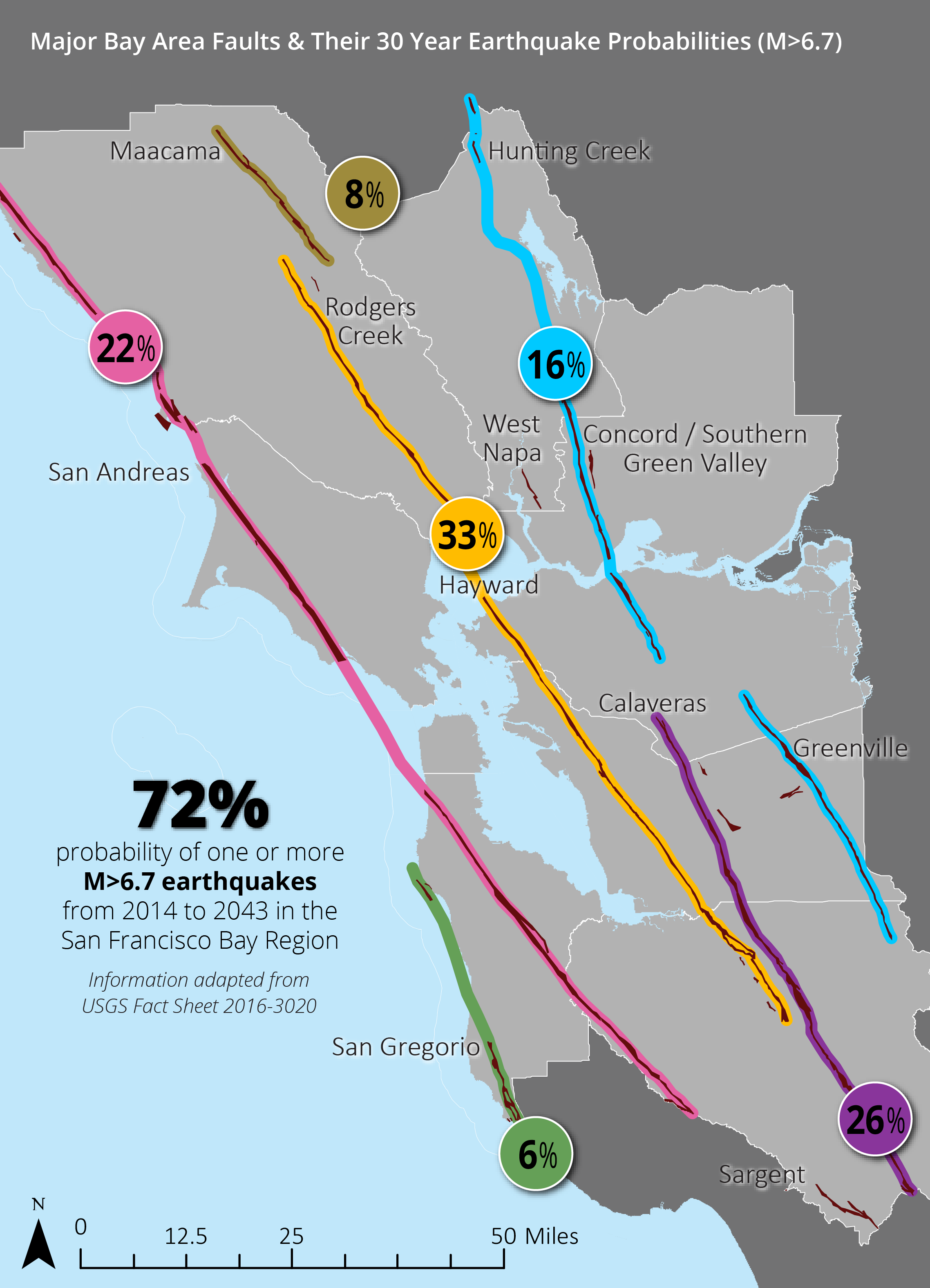
The goal of this month’s map of the month is to convey Bay Area 30 Year Earthquake Risk both in terms of probability of an earthquake occuring anywhere in the Bay Area as well as probability for any given major fault within the region.
This month’s map is a remix of a map produced by the ABAG/MTC Resilience Team, which can be seen below.
Contents
Data Sources
Methodology
Outcome & Products
Data Sources
USGS Earthquake Outlook for the San Francisco Bay Region 2014-2043
Association of Bay Area Governments Resilience Program
Methodology
Probabilities provided by United States Geological Survey. No further analysis performed.
Outcome & Products
Maps, Charts, and Graphics
Written Material
October 2017 Map of the Month Write-Up